A history lesson
The area round Aranmore looks fun on the chart and in the pilot books. There are lots of choices of anchorages in picturesque settings ; purple blue mountains ashore contrast with the pink granite rocks of the coast, and the whole lot is set off by lots of white sandy beaches. All it needs to be just about perfect is some sunshine and settled weather. We decided we had to go there.
Hmm! As we rounded the headland at the North end of the island we were surfing down 3 metre swells.The sky was black , the Westerly wind was gusting to 30 knots and the forecast was for the wind to back into the S or SE in the night. Aranmore roads look nicely sheltered from the West , but rather exposed from the S or E so a hasty look at the chart found a little bay called Cruit Hbr . It was just a few further miles along the coast and should provide shelter from all those directions.
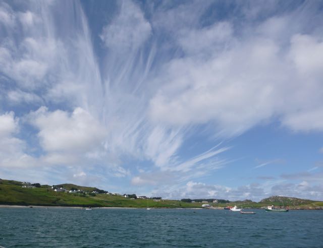
Not only did it do so , it was beautiful into the bargain. To the west , Cruit island ( pronounced “Critch!”) blocked the west wind , a gorgeous sandy beach protected us from the South , the mainland ( with a fine deserted quay) to the East and several small islets and rocky reefs kept the swell from bending round from the North. Three boats swung on moorings and there was room for a whole fleet to anchor, yet we had it to ourselves.
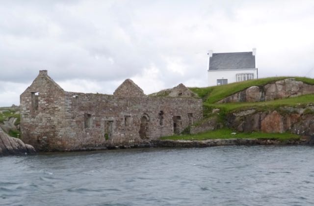
Next day, after a mornings rain, the Southerly wind backed into the West again so we pottered back to Aranmore roads via Owey sound. Owey island , like many hereabouts , was abandoned in the the first half of last century, but the descendants of the original families are gradually rebuilding the ruined cottages as summer homes. First the roofs are repaired , then maybe a lick of paint makes a colourful splash, and finally , some are restored to full splendour, almost certainly better than they ever were before.
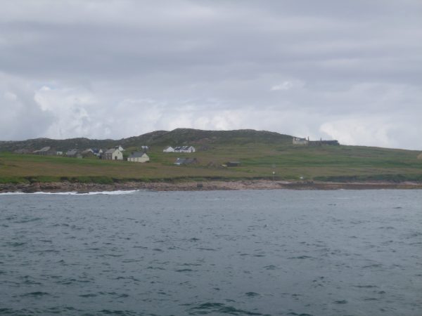
Aranmore has never been abandoned, and a couple of ferries buzz constantly back and forwards from the mainland. I guess that it originally owed its continued population to the relative ease by which sailing ships and fishing vessels could get into its shelter, and this has been maintained by a ferry route that is safe in all but the most ferocious weather. We were still a bit worried about the wind which was due to back into the South again, but the local lifeboatman assured me that the anchorage was quite secure in a Southerly, and a glance at the chart showed another one further in towards the mainland should the wind back further into the East.
The weather was due to get really quite strong for a few days , so rather than be stuck on the boat, after a day exploring the island we decided to moor up in the little harbour of Burtonport ( from where the ferries ply to the island). To get there you pass through a narrow channel between two smaller islands ( Rutland and Eighter) before taking a dredged channel into the harbour walls of Burtonport.
The history of this area is fascinating. Back in the 16th century the colonising English built a port facility in the natural harbour formed by the narrow gut between Rutland and Eighter. I would guess that vessels would lie in Aranmore roads, and in inclement weather warp into the tiny but perfectly sheltered sound between the two islands. At the time it was one of the the most important ports in Ireland, with large warehouses, customs house and even a bank. At some time a huge storm caused half of these buildings to be buried in sand, and the colony withered away . I suspect that another reason was that ships got bigger and it was just too difficult to get these vessels into the narrow channel. The ruins of these substantial buildings still line the channel , some renovated and now interspersed with smart new holiday houses .
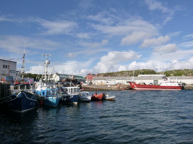
Some time later, a channel was dredged to the mainland shore and Burtonport was blasted out of the rock. No doubt this little port was perfectly adequate for the fishing and trading vessels of the time , and large facilities were built on the shore to cope with the vast tonnage of herring that was landed here , complete with a railway to ship them all away. A lady of our age describes how , as a girl , she loved coming down to the quayside to watch the hustle and bustle of what was still in her lifetime a tremendously busy little port.
What a difference now! A few small boats still work out of there for lobster and crab , but the once crowded quayside is all but empty. The locals claim that there are still loads of fish , but that all the quotas have been sold to the French and Spanish. Undoubtedly fishing boats have moved on as well , and Killybegs , 50 miles down the coast, is rammed full of 200ft multimillion pound “fish hoovers” that are far too big to get into Burtonport , so it has sunk back into obscurity.
The fisherman’s loss is the yachtsman gain as there is now plenty of room for us, but I cant help feeling that small scale fishery from ports like this would be far more beneficial to both the environment and the coastal community than the present state of affairs of industrial scale fishing. Maybe this could be one good thing that could come out of the Brexit fiasco?